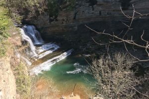
Hiking to Cummins Falls, near Cookeville, is something you should definitely do if you live in or are visiting the Middle Tennessee area. Cummins Falls is a 282 acre day-use only state park about 9 miles north of Cookeville in middle Tennessee. People in this area have been using the swimming hole below the falls for over a 100 years, but it was a well kept secret for a long time.
Eventually, people heard about about the beauty of Cummins Falls and the secret got out. Then in 2011, the land was purchased and officially turned into a state park. It is generally heavily trafficked, especially on nice days.
Hiking Cummins Falls State Park
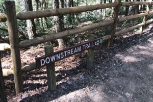
- Blackburn Fork River Trail: .55 miles (downstream trail)
- Blackburn Fork Trail Direct: .30 miles
- Falls Overlook Trail: .45 miles
- John Cummins Trail: .55 miles
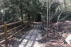
- Terrain: Gravel and dirt
- Features: 75′ Waterfall, overlooks, picnic tables, Blackburn Fork River
- Difficulty: Easy/Moderate
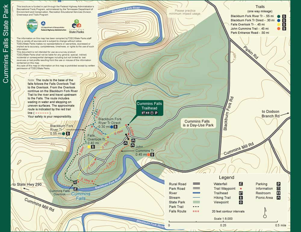
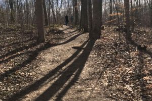
You’ve got a few trail options but they all are heading to one of two places, towards the falls overlook or towards the downstream trail that leads to the base of the falls. I took my kids there today and we hiked the falls overlook trail and the Blackburn Fork River trail. We hiked the downstream trail all the way to the river and turned back there. Past here you need water shoes and we weren’t dressed for walking in water.
The approximately 2 mile roundtrip hike took us a little more than an hour to hike from the parking lot area to the trailhead, on to the falls overlook, down the downstream trail to the river, then back the way we came. You can actually take some shortcuts in various places because it’s kind of a hairpin out and back trail, at least the way we did it was. We weren’t really in a hurry and took our time while I snapped several pictures along the way.
Here is the hike we did:
The falls overlook trail – .45 mile
The Blackburn Fork River trail (downstream trail) – .55 mile
Back the same way – 1 mile
Roundtrip – 2 miles
The falls overlook trail then the Blackburn Fork River trail together are exactly a mile. I did both of these and then back the same way. This is one option for a moderate, 2 mile hike that will show you the falls overlook and take you to the river and back.
If you look at the map above you can see a .10 mile shortcut you can take on the way back from the river to make it a loop hike. I chose not to take this way back and make it a bit more of a challenge by hiking back by the overlook the same way we came in.
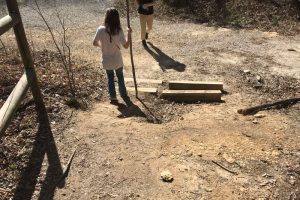
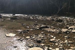
Near the end of the Blackburn Fork River trail is a .2 mile trail that leads you down to the river. This is the most difficult part of the hike. You’ll go down several switchbacks so be careful through here as there is a steep drop-off in several places and the fence rail isn’t always available. Especially if you are passing people and have to move to the other side.
John Cummins Trail
I have not hiked this trail yet so I can’t comment to anything specific. You can see on the map though that this trail is the same length as the falls overlook trail and will still take you to the overlook to see the falls. It runs parallel to and a little bit south of the falls overlook trail.
Falls overlook trail
We took this trail first, it heads straight to the waterfall overlook as the name suggests. This trail is .45 miles long and runs between the John Cummins trail to the south, and the Blackburn Fork River trail to the north. All three trails meet at the overlook. From the overlook you have a few options. You can head back on the way you came to the parking lot and call it a day. Take the John Cummins trail back to the parking lot. Or continue on towards the river on the Blackburn Fork River trail.
Blackburn Fork River trail
This trail starts at the overlook and goes all the way to the river. The hike is bit tougher than the falls overlook trail hike. It’s still a pretty moderate hike though. There are some switchbacks leading down to the river that make a good workout on the way back up. Be careful on the way down these, the ground is bumpy with rocks and roots and there’s a steep drop-off.
This last section of this trail will likely also be the most trafficked part of the hike on a nice warm day. From here you hike upriver all the way to the falls, and the swimming hole at the base. Lots of people swim here in the summer and those hikers may not be hiking the other trails. Most of them probably just came to swim. There are some narrow trails going downhill, so be safe.
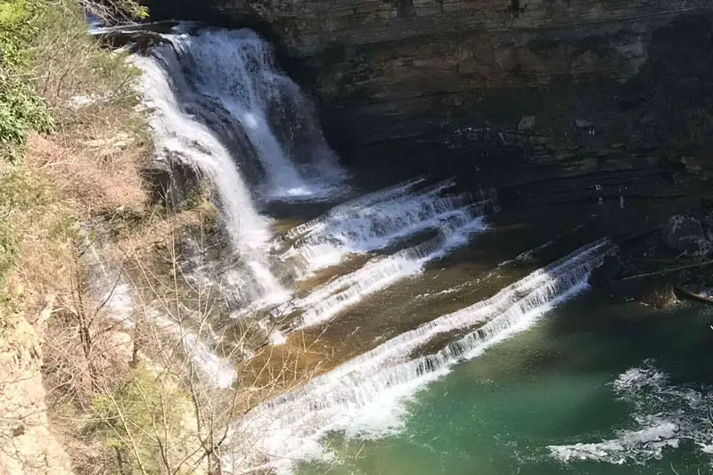
The hike to the base of Cummins Falls
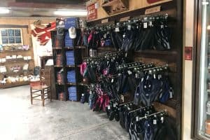
This hike starts after you’ve done the Blackburn Fork River trail to the river. This is where you will need some water shoes. You are going to hike through the river in many spots and being barefoot just won’t work out well. They sell (or maybe rent?) water shoes at the Old Mill store across from the entrance, but they are very flimsy looking (see picture bottom of post).
I went cheap and tried to use some flimsy water shoes when hiking the narrows in Zion National Park, it was a terrible experience. My friend had done that hike and wore some waterproof hiking sandals, he was kind enough to let me wear them on the hike back and they were great. I would highly recommend those for hiking through the river to the Cummins swimming hole.
Anyway, the hike to the falls runs back along the same path as the Blackburn Fork River trail, you’re just now hiking in the river. You’ll hike just over half a mile to get back to the falls. Last time I did this hike there were places you could walk on the bank and places you had to walk through the water. It wasn’t a difficult hike and I had my kids with me. You might consider some hiking poles as well to keep your balance in the river.
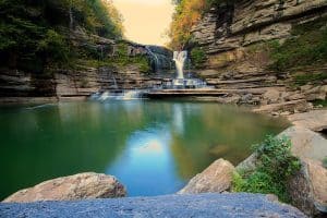
The swimming hole at the end of the hike is great to cool off on a hot day. It’s almost always going to be crowded here on a warm day, but don’t let that stop you from taking a dip in one of the most popular swimming holes in middle Tennessee.
If it has recently been raining, do not attempt to hike through the water. People have died at Cummins more than once due to the currents and flooding after rains.
Who is this hike for?
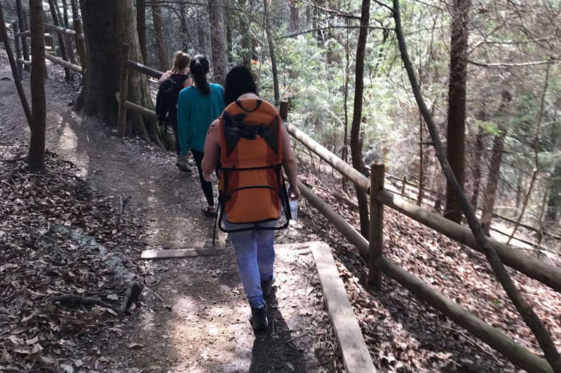
You’ll see families, couples, lone hikers, dogs, and even some babies in carrier backpacks. On a warm and sunny Saturday afternoon, we saw all different types of people of varying ages hiking at Cummins Falls.
I would only warn to be careful on the hike down to the river if you are out of shape, elderly, are bringing small children without a carrier, or are disabled.
Cummins Falls hours and location
As I’ve mentioned, Cummins Falls is a day use park only. There is a gate at the entrance that closes when the park closes. The park hours are below and this is quoted directly from the tnstateparks website.
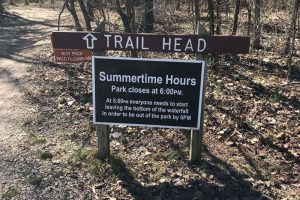
Park Hours are 8:00 AM until 6:00 PM. The gorge area closes at 5:00 PM. People at the bottom of the waterfall must start walking out at 5:00 PM in order to get back to the parking lot and be out of the park by 6:00 PM.
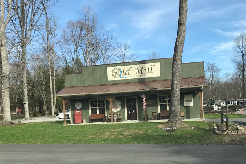
Cummins Falls is located about 9 miles north of Cookeville at 390 Cummins Falls Lane, Cookeville, TN. How you get there is going to depend on where you are coming from. When you get there though, you’ll see The Old Mill store and gift shop right across from the entrance to the park.
Here you can get ice cream, drinks, sandwiches, and some small Cummins Falls gifts. You can also find water shoes here if you plan on making the hike through the river to the swimming hole at the base of the falls. You may want to bring your own water shoes though, some old tennis shoes will work or better yet some hiking sandals like I linked to above are best.
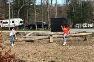
The store does not have public bathrooms, so use the bathrooms at the park before you leave. Behind the store is a campground suitable for RV’s, has a restroom building you can use and some play areas for kids.
Here are some other great hikes in the middle Tennessee area