The interestingly named Fiery Gizzard trail is located within South Cumberland State Park near Chattanooga, Tennessee. This trail is known for it’s beauty, containing waterfalls, rock formations and scenic views. In this article I will talk about my experience hiking the Fiery Gizzard trail, and give you all the tips you need to enjoy your own visit to the park.
Hiking Fiery Gizzard – Grundy to Foster Falls (Doghole Trail)
This trail became one of my favorites after my wife and I hiked the Grundy Day Loop, then later went further to Raven’s Point. Then, to hike the entire trail from end to end become a quest, Grundy Day Loop trailhead to Foster Falls. Training began and even got my brother interested in hiking it. So, on October 5th, 2019 we got up early that Saturday morning and headed out!
- Trail Length: 13.6 miles roundtrip
- Hiking time: 7:15
- Elevation Gain: 1621 ft
- Terrain: Rocks, roots, dirt, uneven ground
- Features: waterfall, amazing views
- Difficulty: Strenuous
Where is the Fiery Gizzard?
The Fiery Gizzard is part of the South Cumberland State Park and this state park has a “friends” group, Friends of South Cumberland State Park, that’s good for information. This trail is considered to be one of the top 25 hikes in the United States.
With this trail being a point to point trail, you can start from either end. Most start from Grundy Day Loop trail and go to Foster Falls.
How to Get To The TrailHeads
Grundy Day Loop Trailhead (131 Fiery Gizzard Rd, Tracy City, TN 37387): From I-24 take exit 134 for U.S. 41A in Monteagle, turn right onto US-41A/W Main St (signs for US 41/Monteagle), turn left onto Fairmont Ave, Fairmont Ave turns slightly right and becomes US-41 S/Tracy Rd, turn right onto 3rd St, turn right onto Marion St, Marion St turns left and becomes Fairground St, Sharp right onto Fiery Gizzard Rd.
Foster Falls Trailhead (498 Foster Falls Rd, Sequatchie, TN 37374): From I-24 take exit 134 for U.S. 41A in Monteagle, turn right onto US-41A/W Main St (signs for US 41/Monteagle), turn left onto Fairmont Ave, Fairmont Ave turns slightly right and becomes US-41 S/Tracy Rd, continue straight onto Colyar St, turn right onto Altamont St/Main St, continue onto US-41 S/7th S, Turn right onto Foster Falls Rd.
About the Fiery Gizzard Hike
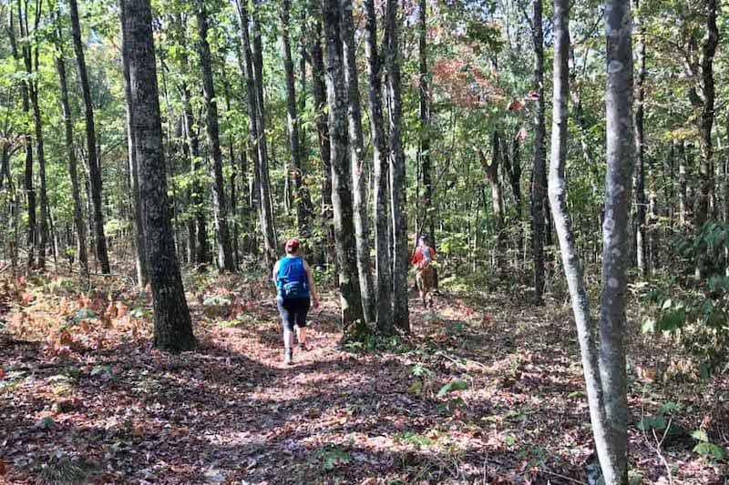
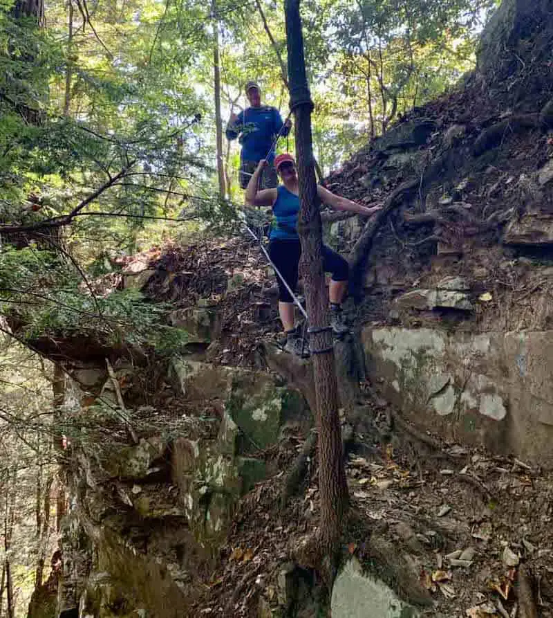
This is a hike I will definitely be doing again. This day we opted to take Dog Hole Trail. In researching for this hike, I had taken the gorge trail to climb to Raven’s Point. The trail was not marked very well and I had read where the markings had gotten a touch worse. I spoke with a few hikers in the months leading up to this hike as well who stated the same thing.
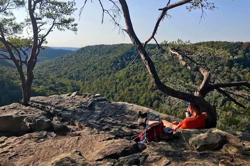
Once we got to Raven’s Point, we took our first break. Not only to rest a bit, but to take in the sights and sounds. It’s such a beautiful spot for a break/lunch. Once you leave Raven’s Point, you go directly to the “reroute” area of the trail.
In 2015 South Cumberland State Park had to shutdown the trail from Raven’s Point to Foster Falls. Over half of the trail is on private property and one of the owners no longer granted access across his property.
In 2016 a second land owner requested the same thing. This reroute area became the most strenuous part of the trail. It was dry when we hiked it, but the reason we want to return is the location of this reroute! The scenery is already awe inspiring, add water flowing and it can only get better!
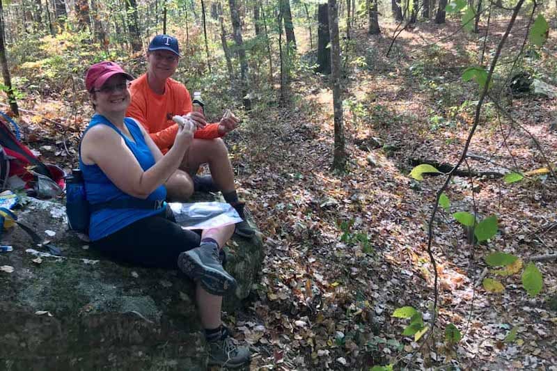
A few miles after this area we finally took a lunch break. While resting on a large rock, we were able to enjoy a nice breeze and enjoyed a tuna fish wrap.
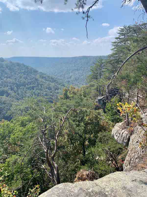
This trail offers several overlook areas. There are a few before Raven’s Point and then again when you are nearing Foster Falls. These are great areas for a break because there is usually always a breeze and the views are worth just sitting and enjoying.
How long does it take to hike the Fiery Gizzard?
On this particular day, we had a total trail time of 7 hours and 15 minutes hiking 13.6 miles.
Why is it called the Fiery Gizzard?
There are several “legends” of how the Fiery Gizzard creek and thus the trail name got its name. One is that Davy Crockett burned his tongue on the gizzard of a turkey and spit it down into a gorge.
Another is an Indian chief threw the gizzard of a turkey into the fire to get the attention of the Europeans during a peace conference. However, I have been told there is a historical marker near Tracy City that recalls an experimental furnace build in the 1870s to see if coal could produce iron. It then received the nickname of “Fiery Gizzard”. The furnace collapsed after burning for 3 days and did not produce much iron.
Who is this hike for?
This is a hike for hikers who are, at a minimum, in moderate shape. You must know your limits, as there are 2 strenuous climbs and one moderate to strenuous climb.
Does Fiery Gizzard Have Camping?
There are campsites, but you must register beforehand. South Cumberland State Park has a standard campground that is open to vehicles, primitive camping, and backcountry campsites. Learn more about camping in South Cumberland State Park here.
One good point after this strenuous hike, you can take a nice swim below Foster Falls and take in the sights and sounds.
Conclusion and Final Tips
- Bring plenty of water and stay hydrated, it’s a long hike
- A hiking pole may help on the uneven ground
- Proper footwear – good hiking shoes or boots will make this hike more comfortable
Article and images by John Ray, originally written for TNhikingreport