Everyone needs that friend who will call you up and say “let’s go on an adventure!” I have a friend like that in my former home city in Virginia, and right before the new year I got that call. She had a couple days off before her kids went back to school, and wanted to know if I was up for exploring. As my husband and I had already discussed taking the kids to the Smokies during that time frame, we invited her along, and she was thrilled to join.
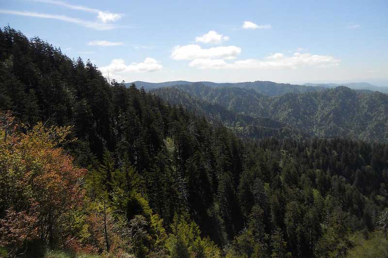
In the six months we’ve lived in Tennessee, we have not been able to explore the Smokies nearly as much as I had hoped. I went camping with the kids in August and didn’t get in a lot of hiking, and we’ve been trying to get back up there ever since. My five year old fell in love with the idea of the Smokies before we even went for the first time, and as much as I love the mountains around Chattanooga, the undeveloped wilderness of the National Parks offers a feeling that’s hard to match. I wanted mountains. And as our hike took place during the recent shutdown of the US Federal Government, I had an extra reason for wanting to go to a National Park: to do our part and help with some trail maintenance.
My natural inclination is to find the path-less-travelled when I am looking for hikes. However, as the Smokies are still new to us, and we did have trail clean-up as an extra reason for going, we sought a more popular trail this time around. We debated between Chimney Tops and Alum Cave, but due to wet trail conditions we opted for the less technical of the two, and set off for the Alum Cave Trail.
Hike Information
Alum Cave
- Trail Length: 4.6 miles out-and-back
- Terrain: Gravel and dirt
- Elevation Gain: 1136′
- Features: Creek, bridges, natural tunnel, views, the “cave”–an 80′ concave overhang
- Difficulty: Moderate
Hike the Alum Cave Trail
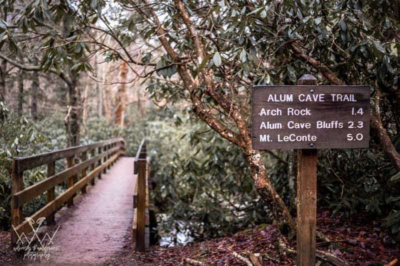
Located just a few miles south of Gatlinburg, the Alum Cave Trail is so popular that it has two parking lots–and both fill up quickly, especially on weekends and when the weather is nice. Whichever lot you park in, there is a small trail from the parking lot that leads to the trailhead proper at the head of a bridge. Here is the trail sign with information about the hike, and some of the flora and fauna you can expect to see while you walk.
The trail sign also gives distances and elevation gain to the popular Mount Le Conte. The Alum Cave Trail is the shortest and least difficult trail to access the Le Conte summit, but results in an 11 mile, strenuous out-and-back. This review will only discuss the first 2.3 miles of the trail to the overhang itself.
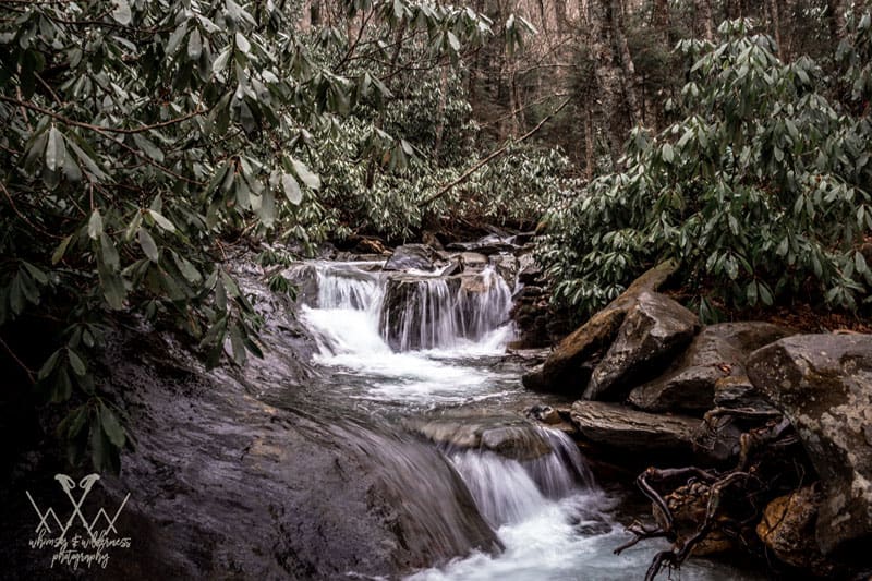
After crossing the bridge, the trail follows the Alum Creek for 1.4 miles, gaining only 555′ in elevation. This stretch takes you through tunnels of massive rhododendron, to the sound of water rushing over rocks in the creek. We were here in the winter and while the rhododendron offered a lovely green background amidst the bare hardwoods, I would love to come back here in June when they are at peak bloom.
Just past the one mile mark you will cross a wide footbridge over the creek, and a hundred yards after that will cross another narrow bridge. This bridge may only be crossed single-file, so exercise courtesy with hikers coming from the other direction. Despite the railing, children or anyone with balance issues or fear of heights may need extra support.
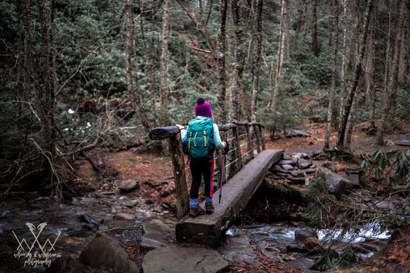
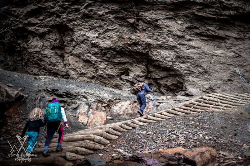
At mile 1.4, reach another narrow bridge leading to the bottom of Arch Rock–an impressive set of steps leading through a natural tunnel formed by years of erosion. The steps take you above the creek with a short but steep drop off to your left. This section can often be wet or even icy, and there are cables strung to the right–part of a 2015 restoration project–that serve as handholds.
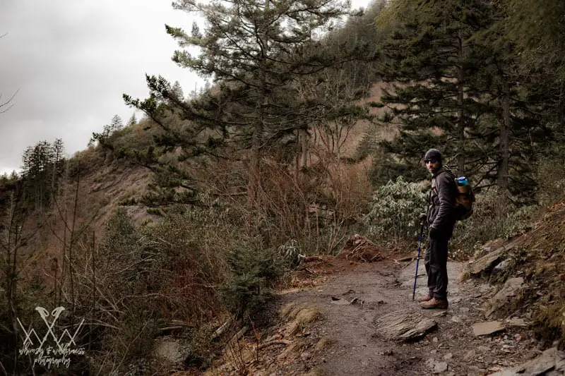
From here, the elevation increases more steadily; if the first half of the trail gained 550′ in 1.4 miles, you will now gain 581′ in less than a mile. There are a couple more seasonal stream crossings that do not have bridges, and a little before the two mile mark you will emerge from the forest to spectacular views of the mountains.
Wind past a view of the Eye of the Needle on Little Duck Hawk Ridge, and reach another wet section with a cable handrail. From here, it’s all stairs leading to the massive overhang that gives the trail its name.
This is a great place to stop for lunch and to take pictures. If you want, you can continue to Mount LeConte for another 2.3 miles, but to complete the Alum Cave Trail, retrace your steps to return to the car.
Features of the Alum Cave Trail
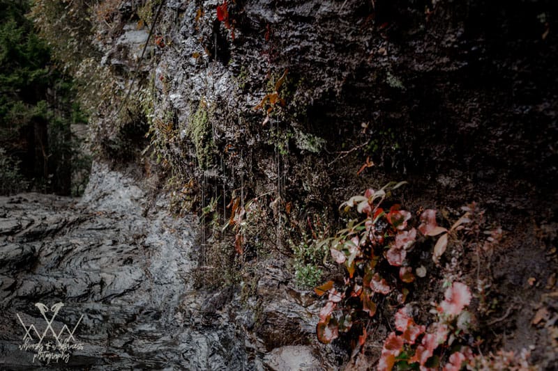
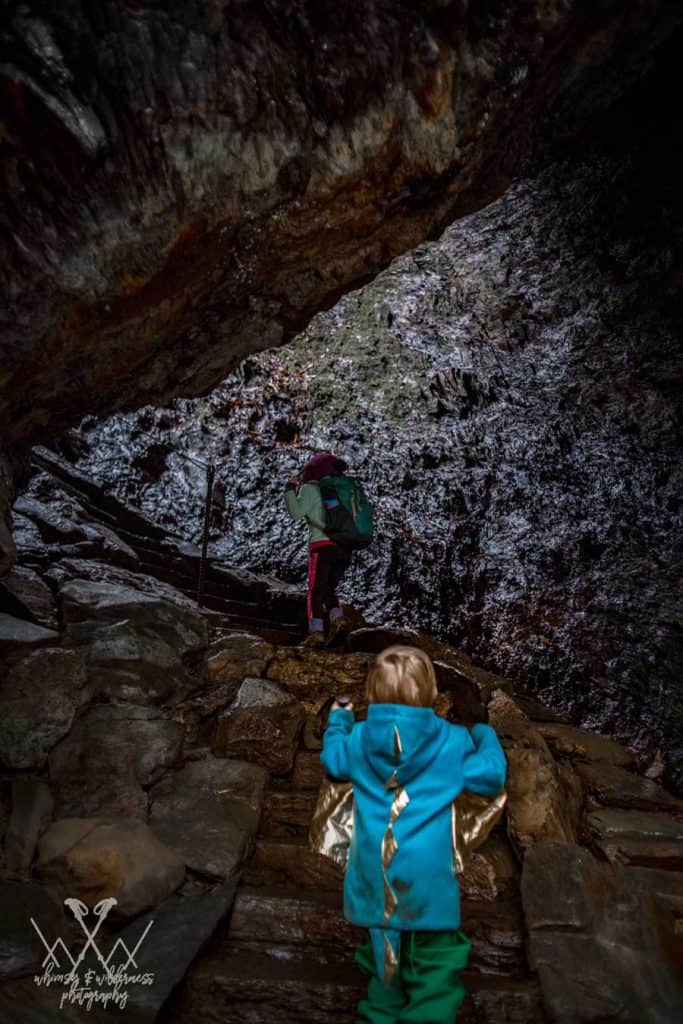
Deceptive in its name, the cave isn’t actually a cave itself, but a huge 80′ concave bluff that stretches almost 500 feet, creating a cave-like opening. My five year old was disappointed–she was definitely expecting a dark cave to explore! Expectations aside however, the overhang is truly impressive.
Though we had moderate weather the day we went due to recent rain, we were treated to water droplets falling from the top of the overhang. According to frequent Smokies hikers, when it is cold enough, these droplets form icicles along the edge of the overhang. This resulted in the trail being rerouted during the aforementioned 2015 restorations, to lessen the time hikers spend in the path of potentially falling ice! Under the overhang however is completely dry and dusty regardless of weather, with beautiful views. If it’s raining this offers a natural shelter to stop and rest.
Another exciting feature of this trail is Arch Rock. This is an incredibly photogenic natural wonder, although the narrow bridging leading to the staircase is frequently congested. It can be hard to get a picture without other hikers in it! Enjoy a unique experience of walking through the tunnel, while exercising courtesy to your fellow hikers.
At around the two mile point you are treated to some beautiful views of the Smokies from a rocky outcrop known as “Inspiration Point.” This is a great place to take pictures of the rugged mountains across the valley and enjoy the mountain laurel and rhododendron growing around you. As mentioned above, you can see the “Eye of the Needle” here as well; a small hole formed in the ridge. Peregrine Falcons next here, so take a few minutes and see if you can spot any.
Who Will Enjoy This Hike?
This is one of the most popular hikes in the Smokies, and for good reason. Although it has a moderate to strenuous rating, it is a “goldilocks” trail, offering some of the best the park has to offer.
The first part of this trail is wide and easy. There are a few sections of steps and short gaps that make the trail inaccessible for strollers or wheelchairs, but the path is well-trodden and free of obstructions. The second half is far more technical, with stairs, bridges, stream crossings, and drop-offs, balancing the relative ease of the first half for anyone seeking more adventure. And the payoff is worth the effort, whether you are new to hiking in the Smokies, or are in the 900-miler club.
The children we had with us loved this trail. Between the backtracking and winding that anyone who has hiked with small children will be familiar with, we clocked over 5 miles for the day. And while the one year old did most of the hike while worn by his mom, my two year old did all but the last half a mile or so on his own two feet. This is where a good child carrier comes in handy.
That had more to do with distance than difficulty, and he loved the stairs at the end, which are arguably the hardest section! Children will love the many opportunities to stop and play in the Alum Creek, and the trail has enough features spaced out to keep them motivated.
As pets are not allowed on trails in the Smokies, this is not a trail for dog-walkers. The extreme popularity of it means crowded trails, which should also make it difficult for trail-running. However for groups, families, or anyone looking to get a taste of hiking in the Smokies, this is definitely a trail for the top of your list.
How To Find the Trailhead
Located near Gatlinburg, head south on 441/Newfound Gap Rd from the Sugarlands Visitor’s Center. After 8.7 miles you will reach the parking lots, which are clearly marked. Plan to get here early, as the parking lots fill up quickly. It is not uncommon to see cars parked along 441 as you get later in the day. There are bathrooms in the parking lot, but they are closed during the winter. Trash cans are also available–though it is always a good idea to pack your trash out of the park to lessen the strain on the NPS’s resources!
Article written by: Stephanie Jacobson